Brace for Impact: Bomb Cyclone Set to Slam British Columbia This Week!
2024-11-16
Author: Benjamin
Brace for Impact: Bomb Cyclone Set to Slam British Columbia This Week!
A powerful and rapidly intensifying storm system is poised to create hazardous conditions across British Columbia as the week progresses, beginning Tuesday and lasting into Wednesday. This fierce weather pattern has the potential to be classified as a bomb cyclone, raising alarms for residents in the affected areas.
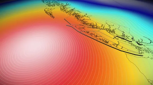
Meteorologists expect this formidable low-pressure system to materialize just west of Vancouver Island on Tuesday, reminiscent of the notorious storm that struck the Pacific Northwest in October 2021. Fortunately, this particular storm is likely to remain offshore, thereby minimizing direct impacts on land; however, it still carries significant threats for the region.
What to Expect: High Winds and Heavy Precipitation
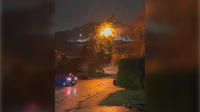
The forecast indicates that high winds will start kicking in on Tuesday and continue into Wednesday, posing risks of power outages and disrupted ferry services. Some locations could also witness heavy rainfall. Residents can anticipate gusts reaching between 90-100 km/h along the Strait of Georgia and coastal Vancouver Island, with the potential for even stronger winds.
Snowfall in the Mountains
While coastal areas brace for wind and rain, mountain regions are set to receive impressive amounts of snow. Ski resorts can expect substantial snowfall, with some areas reporting up to 100 cm as freezing levels drop below 1000 meters. Snow-lovers should rejoice as a winter wonderland awaits!
Meteorological Insights: The Making of a Bomb Cyclone
The energy fueling this impending storm has been traveling over the Bering Sea throughout the weekend, ultimately migrating to the Gulf of Alaska by Monday. This move, combined with a robust jet stream and sharp temperature contrasts, will rapidly intensify the storm system off the B.C. coast come Tuesday.
Notably, the central pressure of this storm could drop from 1004 mb on Monday evening to as low as 948 mb within just 24 hours—a staggering 56 mb decrease that meets the criteria for bombogenesis, the scientific term used for the rapid intensification leading to a bomb cyclone.
Preparedness is Key!
Residents in the Lower Mainland should prepare for winds reaching 50-70 km/h, with the most intense gusts affecting western beaches. As the winds persist, ferry operations are likely to experience delays and cancellations extending into Wednesday.
Moreover, rainfall totals could exceed 100 mm for areas like Tofino and western Vancouver Island, while other South Coast locations may see 30-50 mm of rain. The timing of the storm coinciding with the recent king tide cycle also raises concerns for potential coastal flooding in areas such as Victoria and Campbell River.
Whether you are a weather enthusiast or simply a resident of B.C., stay updated on this developing situation. Find out how to prepare and keep safe as this intense bomb cyclone draws closer. Don't let this storm catch you off guard!


 Brasil (PT)
 Canada (EN)
 Chile (ES)
 España (ES)
 France (FR)
 Hong Kong (EN)
 Italia (IT)
 日本 (JA)
 Magyarország (HU)
 Norge (NO)
 Polska (PL)
 Schweiz (DE)
 Singapore (EN)
 Sverige (SV)
 Suomi (FI)
 Türkiye (TR)