Brace Yourself! Ontario's Snow Squalls Set to Deliver a Whopping 80 cm of Snow!
2024-11-27
Author: Liam
Brace Yourself! Ontario's Snow Squalls Set to Deliver a Whopping 80 cm of Snow!
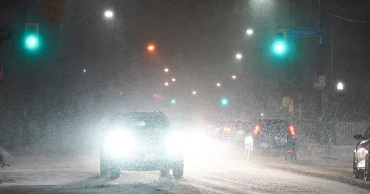
Get ready, Ontario! A significant shift in temperatures over the Great Lakes is poised to unleash "incredible snow totals" across several regions in the coming days. Meteorologists are predicting intense lake-effect snow as warm water temperatures collide with cooler air, setting the stage for what could be one of the most memorable snow events of the season.
According to Global News meteorologist Anthony Farnell, the unusually mild fall has led to record warm water temperatures in the Great Lakes. However, this calm is about to be disrupted. "We’re expecting ideal conditions for lake-effect snow," he said, emphasizing that areas downwind from all five Great Lakes will face treacherous travel conditions this weekend.
The onset of snow squalls will begin early Friday morning, particularly affecting regions around Lake Huron and Georgian Bay, and these squalls are expected to persist into the early part of next week. Farnell warned that because the water is still warm, initial snowfall may be denser and wetter, potentially limiting snow accumulations at first. However, as the wind direction shifts, snow squalls could relocate, delivering heavy snowfall to various communities throughout the weekend.
In the most aggressive squalls, snowfall rates could reach up to 8 cm per hour, accompanied by thunder and lightning—an unusual and startling winter phenomenon. By Monday, Farnell forecasts total snow accumulations reaching a staggering 80 cm in the areas with the most persistent squalls. While much of the Greater Toronto Area (GTA) might dodge the worst of the storm, north and west regions could see significant amounts topping 10 cm.
Snow flurries are anticipated in Toronto, but most likely without substantial accumulation for the city. The colder-than-average temperatures are expected to hang around until December 10, ensuring conditions remain conducive for further snow falls, especially in the areas most impacted by this weekend's weather.
Adding to the excitement, this winter is anticipated to be influenced by a La Niña phenomenon, typically characterized by cooler temperatures and increased precipitation, largely due to warmer waters in the Pacific Ocean. Regions such as British Columbia, Alberta, and southwestern Saskatchewan, as well as central and southwestern Ontario, are likely to experience above-normal levels of precipitation.
Mark your calendars: winter officially begins on December 21, but the snow looks set to come early this year! Prepare for a wintry wonderland and potentially challenging travel conditions—stay safe and bundle up!


 Brasil (PT)
 Canada (EN)
 Chile (ES)
 España (ES)
 France (FR)
 Hong Kong (EN)
 Italia (IT)
 日本 (JA)
 Magyarország (HU)
 Norge (NO)
 Polska (PL)
 Schweiz (DE)
 Singapore (EN)
 Sverige (SV)
 Suomi (FI)
 Türkiye (TR)