Uncovering the Impact of Sea Level Rise on the Bahamas: A Deeper Dive
2024-11-17
Author: Emily
Uncovering the Impact of Sea Level Rise on the Bahamas: A Deeper Dive
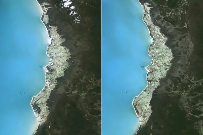
When the renowned University of Miami geologist Robert Ginsberg passed away in 2017, his legacy sparked intrigue among colleagues who stumbled upon an extraordinary collection of black-and-white aerial photographs. These were no ordinary images; they were British Royal Navy reconnaissance photos from World War II, specifically capturing the stunning coastline of Andros Island, the largest island in the Bahamas, in 1943.
By comparing these historical photographs with contemporary Landsat satellite images, researchers have gained critical insights into the dynamic changes wrought by sea level rise on the island's inland marshes over the past eight decades. Remarkably, even as the shoreline appears largely unchanged, the alterations in the interior landscapes tell a different story.
Rising Sea Levels and Their Impact
Tide gauge data reveals that the sea level around Andros Island has risen approximately 10 centimeters (4 inches) from 1985 to 2018, mirroring global sea level changes observed since the 1990s. While data isn't available that stretches back to the 1940s for Andros, experts estimate that since 1950, sea levels in the region have risen by about 0.18 centimeters per year.
University of Miami geologist Sam Purkis, a coauthor of a significant study published in Sedimentary Geology, expressed surprise at their findings. “Given the rapid rate of change, we expected to see a recession of the coastlines. But the shoreline was actually quite stable,” he explained.


 Brasil (PT)
 Canada (EN)
 Chile (ES)
 España (ES)
 France (FR)
 Hong Kong (EN)
 Italia (IT)
 日本 (JA)
 Magyarország (HU)
 Norge (NO)
 Polska (PL)
 Schweiz (DE)
 Singapore (EN)
 Sverige (SV)
 Suomi (FI)
 Türkiye (TR)