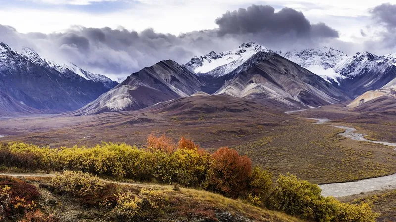
Discovering the Secrets Beneath Denali: How America's Highest Mountain Was Formed by an Ancient Collision
2024-12-23
Author: Lok
Introduction
Scientists have finally unraveled the mystery of a monumental geological fault lying beneath Denali, North America’s tallest mountain. This breakthrough sheds light on the fascinating history of how the Denali Fault was born—specifically, as a result of an ancient collision between tectonic plates millions of years ago.
The Denali Fault
According to groundbreaking research published in October in the journal Geology, the Denali Fault is not just any geological formation; it is an ancient suture where two land masses merged. Between 72 million and 56 million years ago, an oceanic plate known as the Wrangellia Composite Terrane collided with the western edge of North America and fused with it. This event marked the beginning of a fascinating geological history that has shaped the landscape we see today.
Significance of the Research
Sean Regan, a geoscientist from the University of Alaska, Fairbanks, and lead author of the study, emphasized the significance of this research. “Our understanding of lithospheric growth along the western margin of North America is becoming clearer,” Regan stated, indicating that this work enhances our grasp of plate tectonics in the region.
Characteristics of the Denali Fault
The Denali Fault is classified as a strike-slip fault, characterized by the sideways movement of two chunks of continental crust sliding against each other. A notable historical event tied to this fault occurred on November 3, 2002, when a major magnitude 7.9 earthquake shook the region. This tremor was so powerful that it impacted areas more than 1,500 miles away in Seattle, according to reports from NASA's Earth Observatory.
Research Locations and Findings
Regan’s analysis focused on three separate locations along the fault: the Clearwater Mountains in southeastern Alaska, Kluane Lake in Canada’s Yukon Territory, and the Coast Mountains near Juneau. These locations, despite being hundreds of miles apart, span approximately 620 miles along the faultline, revealing a complex geological narrative.
Inverted Metamorphism
Previous research from the 1990s suggested that these three fault segments originated from the same location at a similar time and were later separated by tectonic activity. However, confirmation of that theory was lacking—until now. By studying a rare mineral called monazite, which provides insight into the history of the surrounding rock, Regan was able to offer conclusive evidence for this theory.
Understanding the Geological Framework
“Each of these three independent inverted metamorphic belts all formed at the same time under similar conditions,” Regan explained. This phenomenon, known as inverted metamorphism, occurs when rocks formed under intense heat and pressure are found lying atop those formed at lower temperatures and pressures. This is contrary to the usual pattern observed in Earth’s crust, where deeper formations are hotter and more compressed.
Conclusion
The findings highlight the exciting realization that these three geological regions emerged from the same place—at the terminal suture zone between the North American plate and the Wrangell subplate. This discovery not only enhances our understanding of Denali's geological framework but also reveals the intricate process through which once-separated land masses became stitched together in the fabric of the North American tectonic landscape.
Regan concluded, "We are beginning to recognize the primary features involved in the suturing of once-distant land masses to the North American plate." As researchers continue to explore these geological wonders, the Denali Fault remains a stunning reminder of Earth’s dynamic history and the forces that continue to shape our world. Will there be more secrets hidden beneath the surface? Only time will tell!


 Brasil (PT)
 Canada (EN)
 Chile (ES)
 España (ES)
 France (FR)
 Hong Kong (EN)
 Italia (IT)
 日本 (JA)
 Magyarország (HU)
 Norge (NO)
 Polska (PL)
 Schweiz (DE)
 Singapore (EN)
 Sverige (SV)
 Suomi (FI)
 Türkiye (TR)