NASA Unlocks the Secrets of Earth's Oceans with Revolutionary Satellite Technology!
2024-12-18
Author: Rajesh
Prepare to dive into a world of astonishing discoveries as NASA, in collaboration with France’s CNES, embarks on a groundbreaking mission to map the ocean floors like never before! Despite covering over 70% of the Earth's surface, the depths of our oceans have remained largely uncharted and shrouded in mystery. Traditional ship-based sonar methods have been slow and prohibitively expensive, leaving vast expanses of the seabed unexplored—until now.
Satellite Mapping: A Game Changer for Ocean Exploration
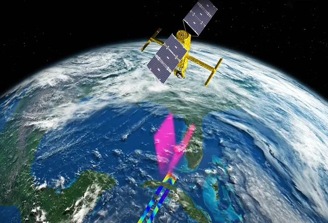
For decades, scientists have relied on detailed ship surveys to gather data about the underwater landscape, a process that has been described as painstakingly slow. A complete mapping of the ocean floor using conventional methods could take over a century! However, the launch of the Surface Water and Ocean Topography (SWOT) satellite represents a monumental leap forward. This innovative tool employs radar altimetry to measure minute variations in sea surface height, allowing researchers to infer the topography of the seabed with striking efficiency.
In just one year of collecting data, SWOT has already transformed our understanding of underwater topography, revealing thousands of undersea peaks and valleys that were previously unknown. These findings not only enhance our geological knowledge but also hold critical implications for oceanic currents, marine ecosystems, and even climate change models.
Unveiling the Hidden Depths
Dr. Yao Yu from the Scripps Institution of Oceanography at UC San Diego states, “The first year of SWOT data has surpassed 30 years of traditional altimeter data in terms of marine gravity assessments.” This new method provides a fine-tuned perspective of features like abyssal hills and seamounts, revealing intricate landscapes crucial for our understanding of ocean dynamics, tsunami behavior, and the habitats of peculiar marine organisms.
Why does this matter, you ask? Each geological feature found below the waves tells a story of tectonic shifts and underwater processes. The detailed maps not only support navigation and resource management—such as monitoring fishing zones and mineral extraction—but also contribute significantly to climate research, as they allow for enhanced simulations of ocean circulation.
Earth's Underwater Landscapes: Conclusions and Implications
Modern oceans are a complex tapestry of geological formations, and with advanced mapping technology, researchers anticipate replete histories of underwater features and the ecological communities that inhabit them. Understanding the interaction between ocean currents and undersea formations will improve predictions of climate trends, providing invaluable insights crucial for shaping our environmental policies.
Moreover, the global initiative known as Seabed 2030 aims to create a complete map of the world’s oceans by 2030, potentially revolutionizing our approach to marine conservation and resource management. With contributions from crowdsourced data and autonomous vessels equipped with state-of-the-art sonar, our comprehension of the underwater world is on the verge of a renaissance.
What Lies Ahead?
The future of ocean mapping is promising, as cutting-edge satellites and advanced analytical techniques continue to evolve. Each new layer of detail uncovered may redefine how we perceive our planet's oceans. New features could reveal critical ecological regions or historical geological events that have shaped climate and biodiversity.
Get ready for a world of insights as scientists continue to push the boundaries of what we know about our planet's most mysterious realms. The oceans are no longer just a blue abyss; they are vibrant ecosystems filled with potential certifications for our climate, our navigation routes, and beyond!
Stay tuned for more incredible updates on this fascinating journey into our oceans—who knows what secrets lurk just beneath the surface waiting to be discovered!


 Brasil (PT)
 Canada (EN)
 Chile (ES)
 España (ES)
 France (FR)
 Hong Kong (EN)
 Italia (IT)
 日本 (JA)
 Magyarország (HU)
 Norge (NO)
 Polska (PL)
 Schweiz (DE)
 Singapore (EN)
 Sverige (SV)
 Suomi (FI)
 Türkiye (TR)