NASA's SWOT Satellite: Unraveling the Ocean's Unseen Wonders
2025-03-22
Author: Wei Ling
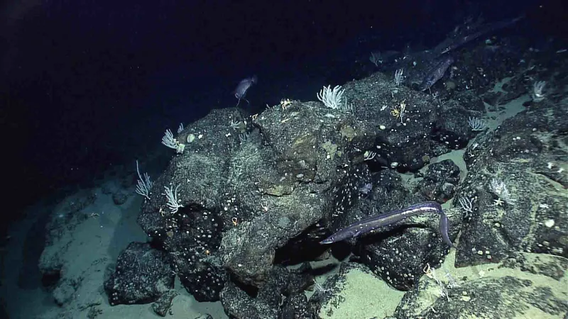
In a surprising revelation, the surfaces of celestial bodies like the Moon, Jupiter, and Venus are more comprehensively mapped than Earth's ocean floor, which still remains a mystery despite covering 71% of our planet. Shockingly, only 25% of the ocean floor has been mapped using traditional ship-based sonar, which forces researchers to rely heavily on advanced satellite technology.
Enter NASA's groundbreaking Surface Water and Ocean Topography (SWOT) satellite, developed in collaboration with the French space agency CNES. Launched in 2021, this innovative satellite is revolutionizing the way we explore and understand our oceans, facilitating the creation of incredibly detailed maps that are set to transform navigation and enhance our knowledge of underwater ecosystems.
Why Underwater Mapping Matters
Accurate underwater maps are essential for many reasons. A dedicated team from the University of California, San Diego, has utilized SWOT data to generate the most comprehensive seafloor map ever created. This advancement not only aids in navigation and the installation of communication cables but also opens up significant opportunities in areas such as seabed mining, optimized shipping routes, and hazard detection. Nadya Vinogradova Shiffer, the head of NASA's physical oceanography programs, highlighted, “Mapping the seafloor is crucial for both current and emerging economic pursuits.”
But the implications go beyond just human needs. These detailed maps will also provide invaluable insight for marine scientists, revealing underwater mountains known as seamounts and smaller abyssal hills, while enhancing our understanding of the tides and currents that drive marine ecosystems.
The Transformative Power of NASA's SWOT Satellite
SWOT's mission extends far beyond just monitoring the oceans. It assesses water levels in lakes, rivers, and reservoirs, converting this data into both freshwater and seawater topographic maps. This capability is particularly significant for tracking sea ice and mapping the ocean floor, marking a colossal leap forward in our ability to observe and comprehend these critical areas.
David Sandwell, a geophysicist from the Scripps Institution of Oceanography, stated, “The SWOT satellite has greatly enhanced our ability to map the seafloor.” Covering 90% of the Earth’s surface every 21 days, this satellite can detect minute differences in sea surface height, allowing researchers to extrapolate the gravitational influences of deep-sea features and predict what lies beneath the ocean's surface.
Amazing High Resolution Discoveries
The new high-resolution data has dramatically increased our understanding of underwater topography. In previous attempts, researchers could only identify large seamounts over a kilometer tall. Thanks to SWOT's capability, scientists have now identified features less than half a kilometer high, increasing the total number of known underwater features from just 44,000 to an impressive 100,000.
Furthermore, this mapping endeavor unveils critical clues about Earth’s geological history. The parallel ridges of abyssal hills are markers of tectonic activity, and by pinpointing their distribution, geologists can trace the movements of tectonic plates throughout history.
"Abyssal hills are the most common landform on Earth, making up about 70% of the ocean floor," explained lead author Yao Yu, an oceanographer at Scripps. “Their small size made them hard to detect from space, so the success of SWOT in identifying them was a pleasant surprise.
A Future of Ocean Exploration
The quest to fully map the ocean floor is ambitious, with goals set for completion by 2030. Although it was anticipated that this feat would rely heavily on traditional ship-based sonar, SWOT's contributions are expected to significantly bridge the gaps in our understanding.
Sandwell remarked, “While we may not fully achieve the complete ship-based mapping by 2030, SWOT is helping us significantly close that gap.”
As we continue to unveil the mysteries beneath the waves, the insights gained from NASA's SWOT satellite hold promise not just for science, but for global navigation, environmental monitoring, and even future industries, mapping the hidden contours of our world's final frontier. Prepare to dive deep into the oceanic unknown; the revelations are just beginning!


 Brasil (PT)
 Canada (EN)
 Chile (ES)
 Česko (CS)
 대한민국 (KO)
 España (ES)
 France (FR)
 Hong Kong (EN)
 Italia (IT)
 日本 (JA)
 Magyarország (HU)
 Norge (NO)
 Polska (PL)
 Schweiz (DE)
 Singapore (EN)
 Sverige (SV)
 Suomi (FI)
 Türkiye (TR)
 الإمارات العربية المتحدة (AR)