Snowstorm Slams London Region: How Will You Survive the Biggest Blast Yet?
2024-12-02
Author: Emily
Snowstorm Overview
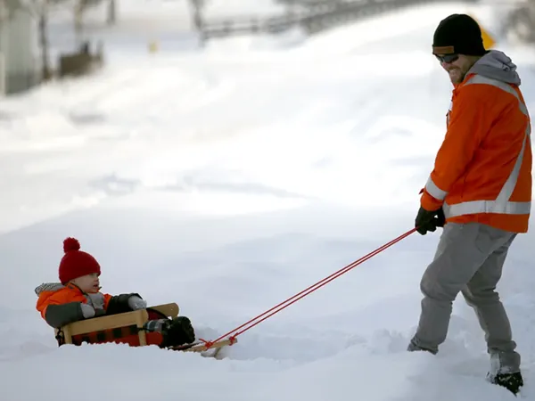
The London region is in for a chaotic winter surprise as Environment Canada warns of an additional 60 centimeters of snow expected to fall on top of the significant amounts already accumulated since Sunday. This weather system has already wreaked havoc, grounding flights and forcing the cancellation of school buses.
Current Weather Situation
Meteorologist Geoff Coulson elaborated on the unfolding situation, stating that a strong band of snow is currently moving inland from Lake Huron, particularly impacting areas like Goderich and Exeter. "These northwesterly winds will remain a factor into Tuesday," Coulson added, indicating that residents should prepare for substantial snowfall over the next 24 to 36 hours.
Causes of the Snowstorm
The recent warm November weather, which kept lake temperatures above normal, combined with an intrusion of Arctic air, has created the perfect conditions for intense lake-effect snow. This has turned local roads into winter wonderlands, but not in a fun way. Ontario Provincial Police have urged people to avoid travel if at all possible. "Stay home where you can be safe," urged Sgt. Ed Sanchuk through social media channels.
Travel Impacts
The winter weather has already disrupted travel plans, with both Air Canada flights from London International Airport to Toronto cancelled. While the city has not faced any major accidents, nearby counties have reported numerous vehicles stuck in snowdrifts and ditches. Police are doing their best to assist stranded drivers alongside local tow operators.
Educational Disruptions
In educational news, all Thames Valley District school board buses were grounded due to "unplowed roads, blowing snow, and poor visibility." However, most schools remained open, while select institutions experienced closures. The London District Catholic school board faced similar cancellations, with schools still managing to operate.
Ongoing Weather Warnings
As of Monday morning, snow squall warnings were active over several areas, including London and surrounding counties. City officials reported significant snowfall accumulation in the northeast end of London, and salt trucks and snowplows were deployed early in the morning to combat hazardous travel conditions. The weather forecast indicates peak snowfall rates between five to ten centimeters per hour, creating near-zero visibility in many regions.
Potential Power Outages
What’s even more dire? Power outages could be anticipated due to the heavy and wet snow blanketing the region. And the snow isn’t done yet! A larger weather system could bring another sprinkling of five to ten centimeters Tuesday into Wednesday. Plus, it looks like Thursday may see more lake-effect snow, as freezing temperatures flood in behind the previous system.
Preparation Tips
Prepare yourselves, Londoners! Stock up on essentials, check your snow shovels, and stay tuned for updates as this winter storm unfolds. Is your home prepared for the snow? What tips do you have to stay safe during a snowstorm? Share your thoughts and stay warm!


 Brasil (PT)
 Canada (EN)
 Chile (ES)
 España (ES)
 France (FR)
 Hong Kong (EN)
 Italia (IT)
 日本 (JA)
 Magyarország (HU)
 Norge (NO)
 Polska (PL)
 Schweiz (DE)
 Singapore (EN)
 Sverige (SV)
 Suomi (FI)
 Türkiye (TR)